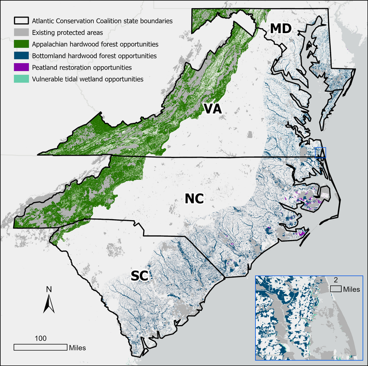
Map of Atlantic Conservation Coalition state boundaries detailing existing protected areas and restoration opportunities across Maryland, Virginia, North Carolina, and South Carolina

ACC Accomplishments:

Conservation Land Acquisition

  • 2,727 acres NC pocosin
  • 1,397 acres MD forest
  • 4,625 acres SC floodplain forest

Community Engagement & Robust Landowner Outreach

  • 134 engagement activities
  • 7,327 individuals reached

Project Implementation

  • Commitment: 29 sites; 96,526 acres
  • Planning, design & approvals: 13 sites; 5,724 acres
  • Implementation: 17 sites; 18,959 acres
  • Complete/monitoring: 2 sites; 53 acres

Revised NC Natural and Working Lands Plan
North Carolina Department of Natural & Cultural Resources logo
South Carolina Office of Resilience logo
Virginia Department of Environmental Quality logo
Maryland Department of the Environment logo
The Nature Conservancy logo

This project has been funded wholly or in part by the United States Environmental Protection Agency under assistance agreement 3D25824 to the North Carolina Department of Natural and Cultural Resources. The contents of this document do not necessarily reflect the views and policies of the Environmental Protection Agency, nor does the Environmental Protection Agency endorse trade names or recommend the use of commercial products mentioned in this document, as well as any images, video, text, or other content created by generative artificial intelligence tools, nor does any such content necessarily reflect the views and policies of the Environmental Protection Agency EPA.

Learn more at: duke.is/accdash

Version 7.2.2026